Services
CIVIL ENGINEERING AND CONSULTING
Alfred Civil Engineering's engineers and designers have provided civil engineering services for commercial, governmental, industrial and residential projects. We offer our clients the latest engineering modeling for: urban and agricultural stormwater management systems, water distribution and wastewater collection systems, and site development services.
From conceptual design, through construction plans and permitting, and then finally through the construction phase of a project, Alfred Civil Engineering can assist with your engineering needs. Every project has its own set of unique challenges. Understanding these hurdles and overcoming them in a timely manner helps us meet client expectations. We provide solutions that meet project challenges with reasonable installation and maintenance costs experienced by our clients.
Alfred Civil Engineering's services include:
- Paving and Drainage Plan Design
- Water and Sewer Plan Design
- Storm drain design
- Stormwater modeling
- Stormwater Pollution Prevention Plan (SWPPP) Reports
- National Pollutant Discharge Elimination System (NPDES) Permits
- Best Management Practice (BMP) and Low Impact Development (LID) Plans
- Hydromodification, Erosion and Sedimentation Control Plans
- Hydrologic Modeling
- Hydraulic Modeling of Pressure and Gravity Pipe
- Lift/Pump Station Design
- Grading Plans and Earthwork Analysis
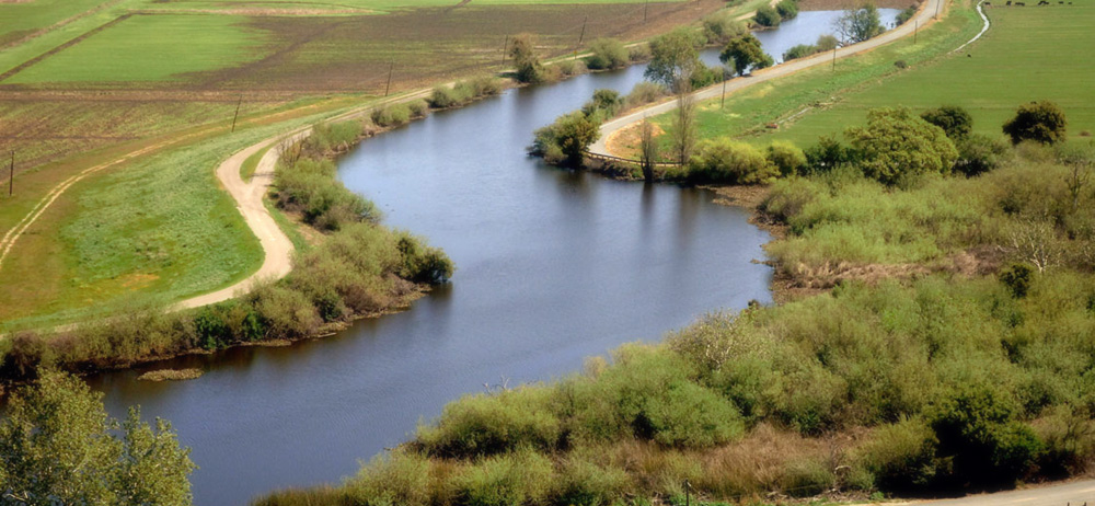
FLOODPLAIN MAPPING AND MANAGEMENT
Rivers and their associated floodplains serve a variety of important natural functions including conveying water and sediment, storing flood waters, and providing diverse habitat. Floodplains, however, are also prime areas for agriculture and commercial and residential development that may be prone to flood damage. Floodplain analysis and management seeks a balance between conserving natural functions and reducing flood risks.
Alfred Civil Engineering investigates and analyzes floodplains ranging in size from small urban streams to the world's largest rivers, and in geomorphic settings from alluvial fans to major river deltas. We participate in small-scale restoration projects and conduct flood damage risk assessments and mapping. Regardless of project scale or setting, we emphasize the need for a thorough understanding of the hydraulics and morphology of rivers and floodplains, and pay close attention to the objectives of the project and the client.
Alfred Civil Engineering's services include:
- Flood Damage Risk Assessment and Mapping
- Flood Hazard Management
- Regulatory Compliance
- Natural and Beneficial Floodplain Value Mitigation and Restoration
SEDIMENTATION ENGINEERING
Sedimentation engineering studies are often essential to successfully design and manage engineering works along rivers, lakes, and reservoirs that may be affected by erosional processes and sediment transport and deposition. Quantitative sedimentation engineering also helps meet environmental objectives, including conserving and improving aquatic habitat and restoring physically and biologically degraded streams. Alfred Civil Engineering's sedimentation engineering studies are often conducted with geomorphic studies that examine erosion hazards, sediment sources, stream morphology and processes, and associated habitat problems.
Alfred Civil Engineering's services include:
- Natural Channel Design for Slope Stability
- Erosion Control
- Sediment Management
STREAM AND WETLAND HABITAT RESTORATION
Stream and wetland habitats provide highly valued ecological, recreational, and water quality benefits to society. These habitats are crucial to protect threatened and endangered species, and they face competing demands for water and land use. Their protection and restoration are key components of integrated water resources planning.
Alfred Civil Engineering applies technical expertise to understand physical processes, in both natural and man-made settings, to assist in protecting and restoring natural functions in streams and wetlands. We work with aquatic, riparian, and wetland ecologists to integrate physical processes and biological communities for use in restoration planning. We emphasize restoration designs that encourage self-sustaining evolution in both physical and biological systems.
Alfred Civil Engineering's specialized capabilities in this area include field investigations and hydrographic measurements, spatial and trend analyses in GIS, hydraulic analysis using 1-, 2-, and 3-dimensional numerical models, and a full range of design services.
Alfred Civil Engineering's services include:
- Hydrologic, geomorphic, hydraulic, and sediment transport analyses
- Channel restoration
- Bio-engineered bank stabilization
CLIMATE CHANGE IMPACTS AND ADAPTATION
Through its effects on water resources, climate change impacts food security, energy production, ecosystem health, and public safety. Ongoing and projected climate change will result in sea level rise with increased risk of flooding and erosion in coastal areas, reduced winter snow accumulation and decreased water supply, changes in flood and drought frequency and severity, and loss of aquatic habitat. Evaluating and understanding the potential impacts of climate change on water resource systems and operations can assist managers in developing strategies that anticipate and adapt to future climatic conditions.
Alfred Civil Engineering's services include:
- Climate change impact on hydrology and water supply
- Sea level rise impacts on flooding and transportation
GIS SERVICES
Geographic Information Systems (GIS) allow people to understand complex data and then apply that knowledge to overcome challenges. Using advanced GIS applications in hydrologic and hydraulic engineering, fluvial geomorphology, and water resources design, Alfred Civil Engineering can manage and analyze spatially referenced project data using the most current and complete datasets. This allows us to better integrate project planning, field activities, design, assessment, land acquisition, public engagement, construction, and environmental restoration tasks.
Our experts' varied educational and technical GIS backgrounds allow us to develop innovative systems that capture, analyze, store, and display the often dissimilar types and formats of available geographic data for a project. Collectively, our programming expertise includes automated terrain processing and floodplain mapping, geo-database design and maintenance, and engineering model integration.
Alfred Civil Engineering uses GIS techniques to support its studies in hydrology, numerical hydraulic modeling, flood control, habitat restoration, channel morphology, dredging, fish habitat assessment, coastal geomorphology, identification and inventory of stream crossings, and watershed restoration.
Our GIS-based services include:
- Database Design
- Programming development and design of databases as well as data collection
- Data Maintenance and Construction
- Spatial and Image Analysis
- Custom GIS Work
- Flood risk analysis and floodplain mapping and management
- Numerical Modeling
- Pre- and post-processing of data as well as mapping of results
